
Construction site photos via WhatsApp – and still structured within the project
14.09.2026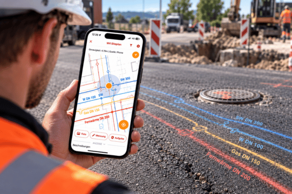

PDF remains the central format for exchanging information between planning and construction execution. Execution, management, or detail plans are submitted as PDFs – and are often still printed out for the construction site.
This brings with it familiar problems: Large paper plans are unwieldy and prone to weathering. When changes are made to the plan, new versions must be distributed and old ones collected again. If an outdated plan remains in the construction container or vehicle, there is a risk that work will be carried out based on the incorrect plan status.
Digital is easier: The correct plan is available on your smartphone or tablet at any time. But just opening a PDF on the screen does not solve everything. The crucial question remains: Where exactly am I in the plan?
This is where georeferencing comes into play.
The PDF is converted into a digital construction site map
With SitePlan, ordinary PDF plans can be easily georeferenced themselves. For this purpose, only Two known reference points in the PDF were selected and the corresponding coordinates assigned to them. SitePlan then automatically calculates the plan in spatial terms.
This makes the user's own GPS position visible directly in the plan. If you move over the construction site, the position in the plan also moves along with you.
Instead of having to search for reference points painstakingly, one immediately sees: Here I am – and that is planned for this place.
Document photos directly on the plan
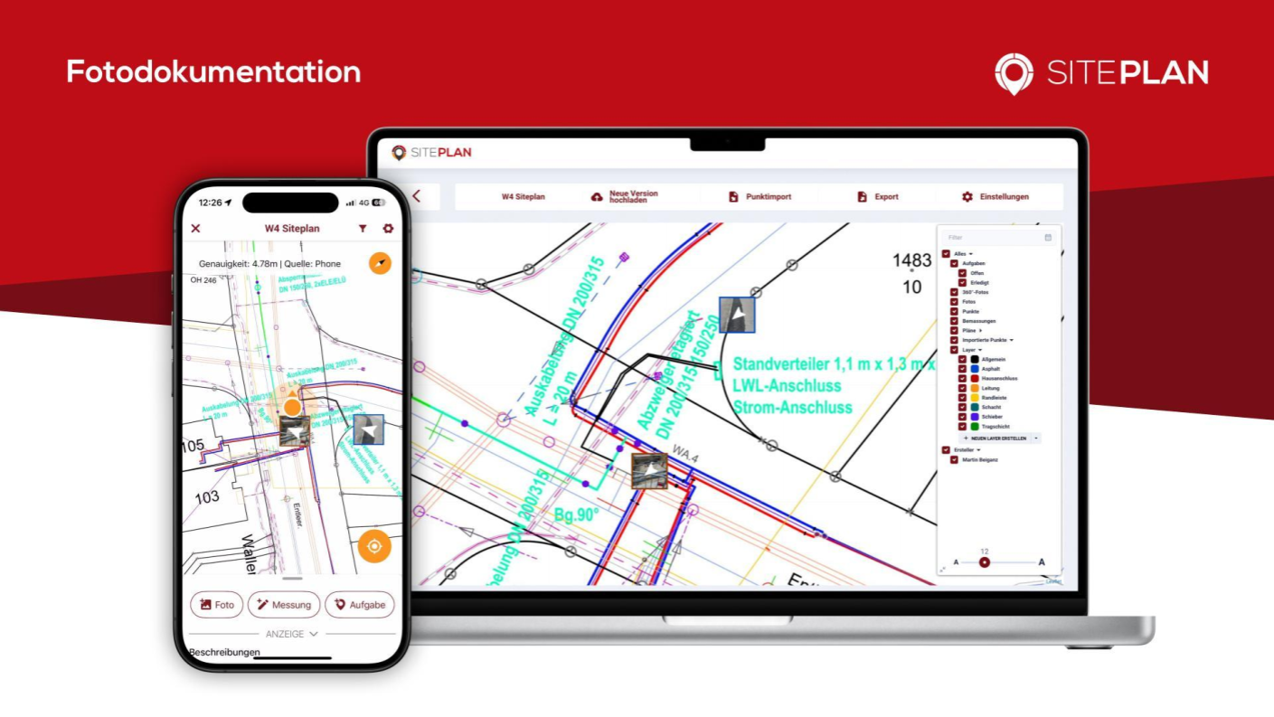
The georeferenced PDF plan serves as the basis for the photo documentation at the same time.
Construction site photos are based on their GPS location located directly on the plan. Before filling, pits, installations or the progress of construction are photographed, but they are also assigned a spatial location.
The photos are automatically synchronized and are therefore also available in the office in the web app.
Overlapping plans and recognizing connections
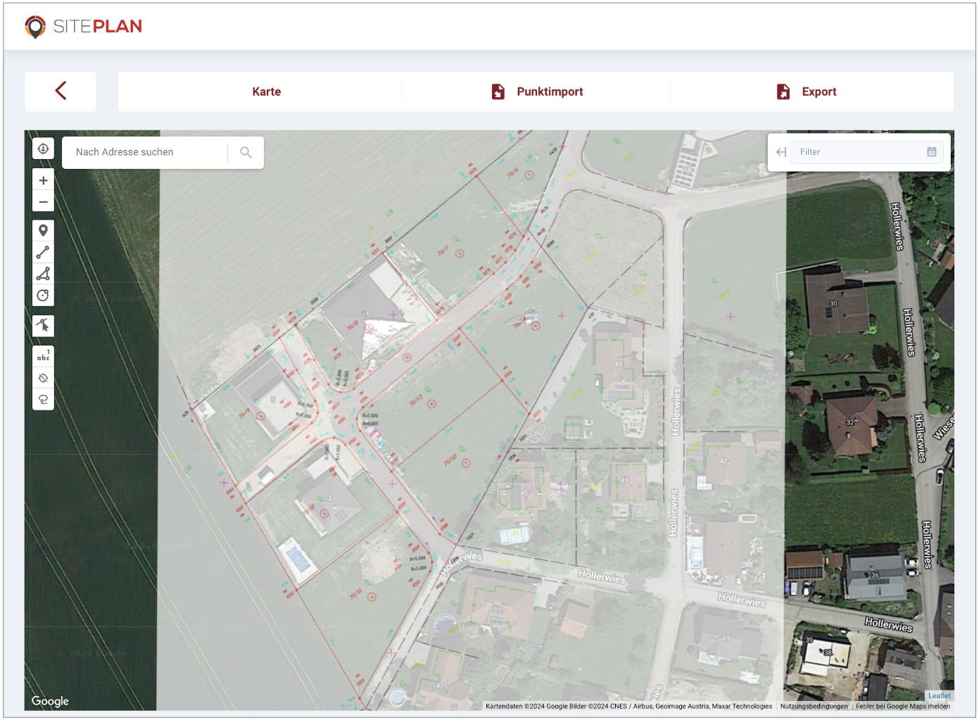
Georeferencing also offers benefits in the office. In the SitePlan web app, PDF plans can be overlapped with the integrated satellite map will be.
Similarly, several georeferenced PDF plans can be displayed on top of each other – for example, inventory, wiring, and execution plans.
This makes spatial relationships more easily understood, different plans can be compared, and Possible collisions can be detected more easily.
GNSS makes plan reading a waste of time
The system goes one step further when combined with a GNSS antenna, which provides an accuracy of up to 1 cm on the smartphone.
With this, the PDF plan can be used not only for orientation and photo documentation, but also for simple Wiring and localization work.
A planned shaft, a pipeline or another point in the PDF plan can be selected and precisely located on site.
A PDF – with significantly more possibilities
The PDF does not have to be replaced by a more complex plan format at all. SitePlan makes the already existing PDF even more useful.
The correct plan is always available and is made available through georeferencing to the digital construction site map – for GPS-based plan reading, georeferenced photo documentation, plan overlays, and even for simple connection work with GNSS.
The PDF plan remains. But suddenly he knows where you stand.