BIM in civil engineering: lots of buzzwords - but enormous potential
27.03.2026
SitePlan is ISO 27001 certified – what that means for your project data
20.07.2026
This is how your photo documentation will finally become usable
Modern civil engineering construction site – but a photo documentation as from 20 years ago?
Many people know this:
Photos are taken quickly – but without a clear connection.
And later in the office?
- „Where was that again?“
- „When was this recorded?“
- „Was that even this construction phase?“
This is exactly where the problem begins.
Photos are here - but not usable as proof.
Photo documentary today: a lot of effort, little impact
In many projects, this is still how it works:
- Photos are being taken (cell phone)
- No assignment to location or construction phase
- Share via WhatsApp or email
- In the office: Search, sort, explain
- Compile photo report manually
Result:
Wasted time, uncertainty—and, in the worst case, missing documentation.
In civil engineering, this can quickly become expensive.
The key difference: context instead of chaos
With SitePlan, every photo immediately becomes a clear, verifiable data set:
- automatic GPS-tagged
- with Timestamp to understand
- right in the Plan or visible on the map
- supplemented with Description and Layer
Every image sits exactly where it was taken – no more guesswork.
Photo Report: The Real Goal
The biggest difference is not shown when taking photos – but in the result: the Photo report.
Because that's exactly what it's about in practice:
Proof for clients, construction supervision, and billing
With SitePlan, this report is created virtually automatically.
Photo report finished in a few clicks
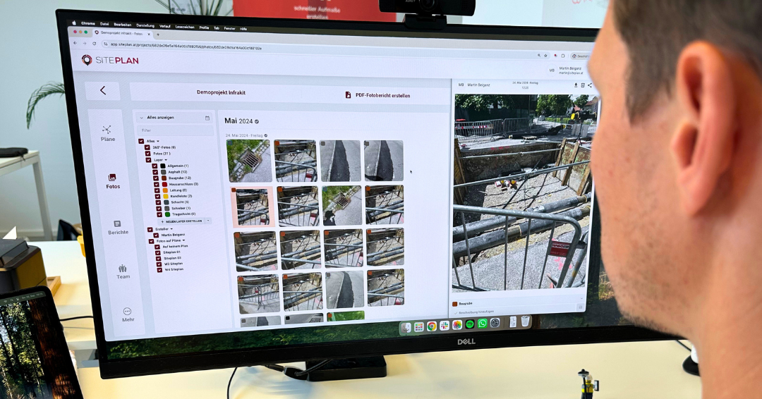
Once the photos are taken, the report is already prepared.
In the web portal:
- Select photos
- Create Report
Finished full photo report as PDF
All content will be automatically accepted:
- Photos
- Position (GPS)
- Date & Time
- Description
- Project Context
Optional
Photo overview map (PDF), with all images directly on the site plan.
This is what a modern photo report looks like
Structured Report
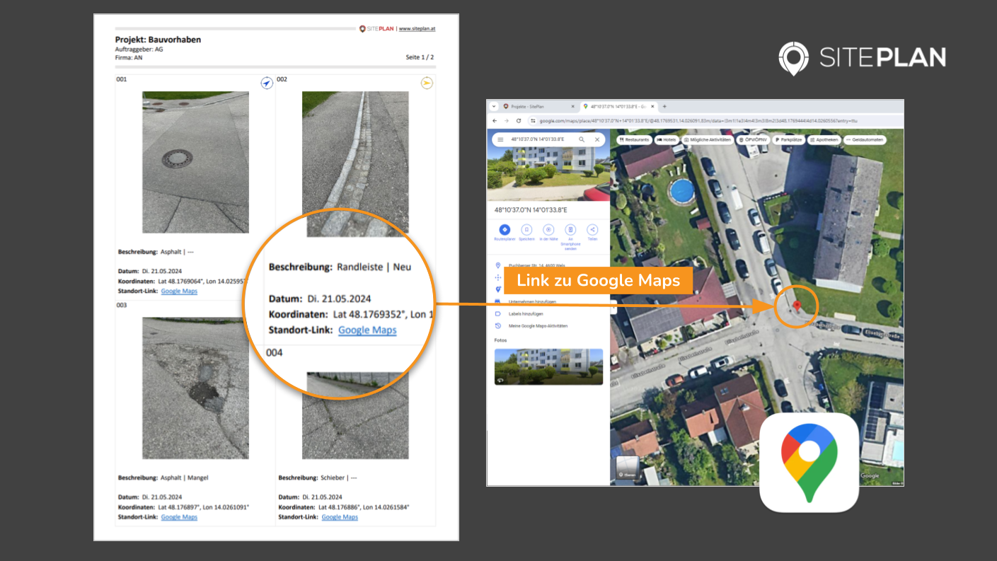
Each image automatically contains:
- GPS coordinates
- Timestamp
- Description
- Assignment (Layer / Section)
- Link to Google Maps
No manual post-processing required.
2. PDF Overview Plan for the Report

All photos are directly visible in the PDF plan or on the PDF satellite map via the linked ID and direction arrow.
Immediately recognizable where it was documented.
3. Clear Evidence
All information is documented completely and comprehensibly.
Ideal for:
- Billing
- Addenda
- Handover
- Disputes
Why that matters so much in practice
The difference is simple:
Classic
Take a photo → store it unstructured → search and guess later
With SitePlan:
Take photo → Report complete
This means specifically:
✔ No more searching for photos
No manual assembly
✔ No loss of information
Clear, understandable proof
Photo documentation goes from time-waster to real tool
Conclusion: The photo report decides – not the photo
A single photo doesn't show much.
A well-organized photo essay provides clarity.
With SitePlan, this turns into:
- „I took a photo...“
one complete, verifiable proof at the push of a button
And that's exactly what saves time, nerves – and secures your billing.
Get out of photo chaos now
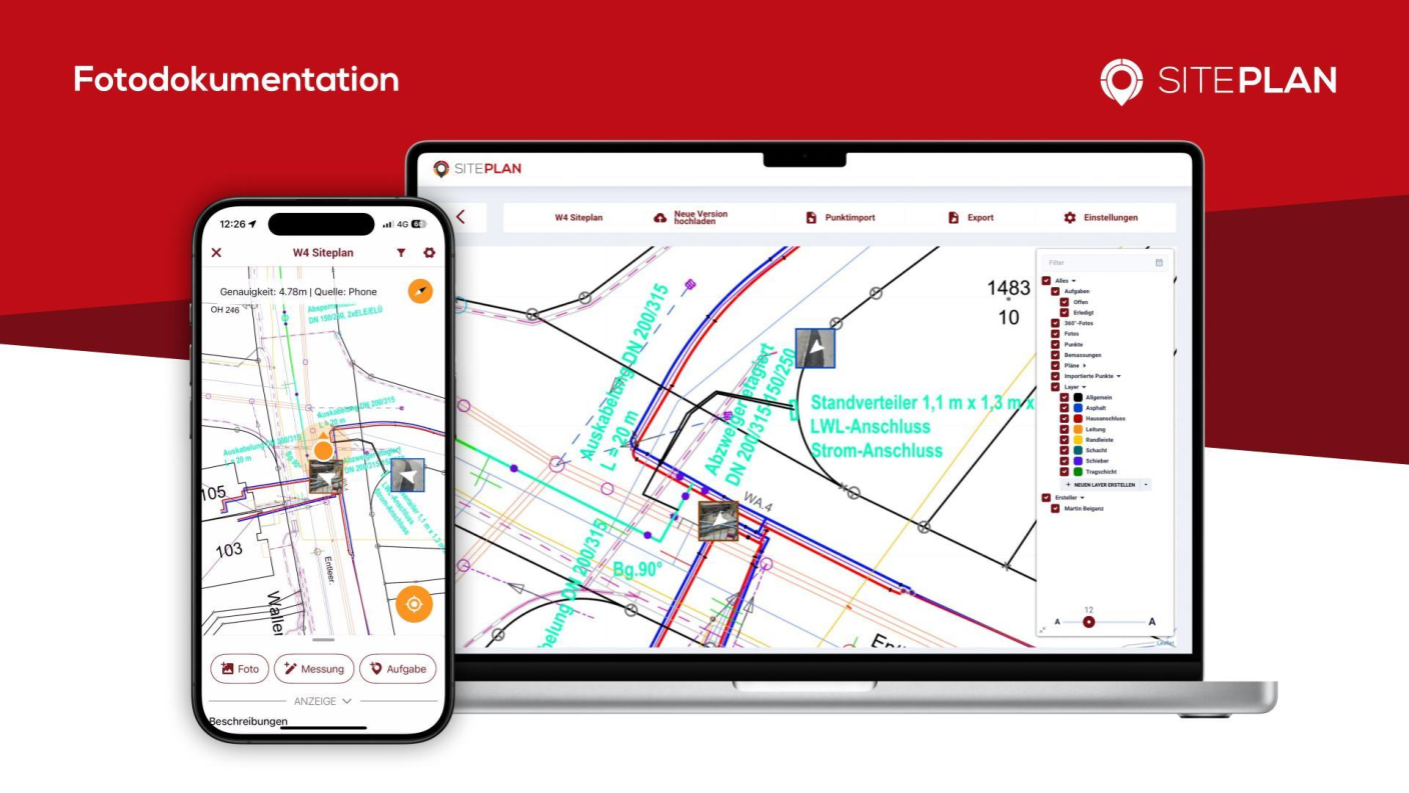
Would you like to see how GPS photo documentation works in practice?