

Surveying App for Site Managers, Foremen & Cost Engineers:
Das Google Maps für den Straßenbau
Still using measuring wheels, paper notes, and disorganized photos?
➔ Aufmaß von Asphaltflächen & GPS-Fotodoku per App
➔ Centimeter-level accuracy with smartphone + GNSS antenna
➔ Seamless reports generated in just 3 clicks
Made possible by SitePlan.
Over 20,000 projects digitized







5x
faster field surveys
With smartphone + GNSS instead of measuring wheels and paperwork
100%
billing proof
Thanks to GPS photos and tamper-proof reports
80%
less surveying costs
Stake out and measure yourself – no external surveyor required
70%
fewer
Nacharbeiten
Durch präzises Aufmaß und vollständige Dokumentation
GPS-Photo Docu
With SitePlan, construction photos don’t end up somewhere—they’re saved exactly where they were taken: geo-referenced via GPS. Whether on the integrated satellite map or in geo-referenced PDF plans.
So werden Asphaltflächen, Bordsteine, Rinnen oder Einbauten eindeutig dokumentiert – und Rückfragen zwischen Baustelle, Büro und Auftraggeber vermieden.

All plans and photos live on every team member’s smartphone

GPS-tagged photos placed on maps or geo-referenced plans

Tamper-proof photo reports – generated in seconds
Digital Field Measurements
Erfassen Sie Asphaltflächen, Bordsteine oder Entwässerungseinrichtungen direkt vor Ort – zentimetergenau, digital und ohne Messrad oder Maßband.
With SitePlan, the construction site team documents independently with a smartphone and GNSS antenna – quickly, precisely, and exportable in just a few clicks.

No more measuring wheels or tape

Zentimetergenaue Doku ausgeführter Straßenbauleistungen

Finished reports in 3 clicks – no more unpaid work
Staking out & Localization
Mit SitePlan führen Sie Absteckungen direkt auf Basis georeferenzierter Pläne oder importierter Koordinatenlisten durch schnell, präzise und ohne externe Vermessung. Simply upload a plan or import point data, connect your GNSS antenna, and get started.
Ebenso lassen sich Bestandspunkte und Einbauten einfach lokalisieren.

Absteckung direkt durch das Baustellenteam

No waiting times for external surveys

Save up to 80% on surveying costs

Result: Up to 80% time savings and significantly higher margins
Was Google Maps für den Alltag ist, ist SitePlan für den Straßenbau.
Bauleiter und Poliere dokumentieren Straßenbauleistungen digital – lückenlos, nachvollziehbar und in Echtzeit.
No delays. No lost measurements. No more disputes with clients.
All data is immediately available at the office – and that pays off on every project.
Positive ROI usually after just a few weeks:
✔ Up to 80% time savings on site and in the office
✔ Staking out without a surveyor – saves time and money
✔ Reports in 3 clicks – complete, verifiable, watertight
✔ 100% billable work thanks to seamless documentation

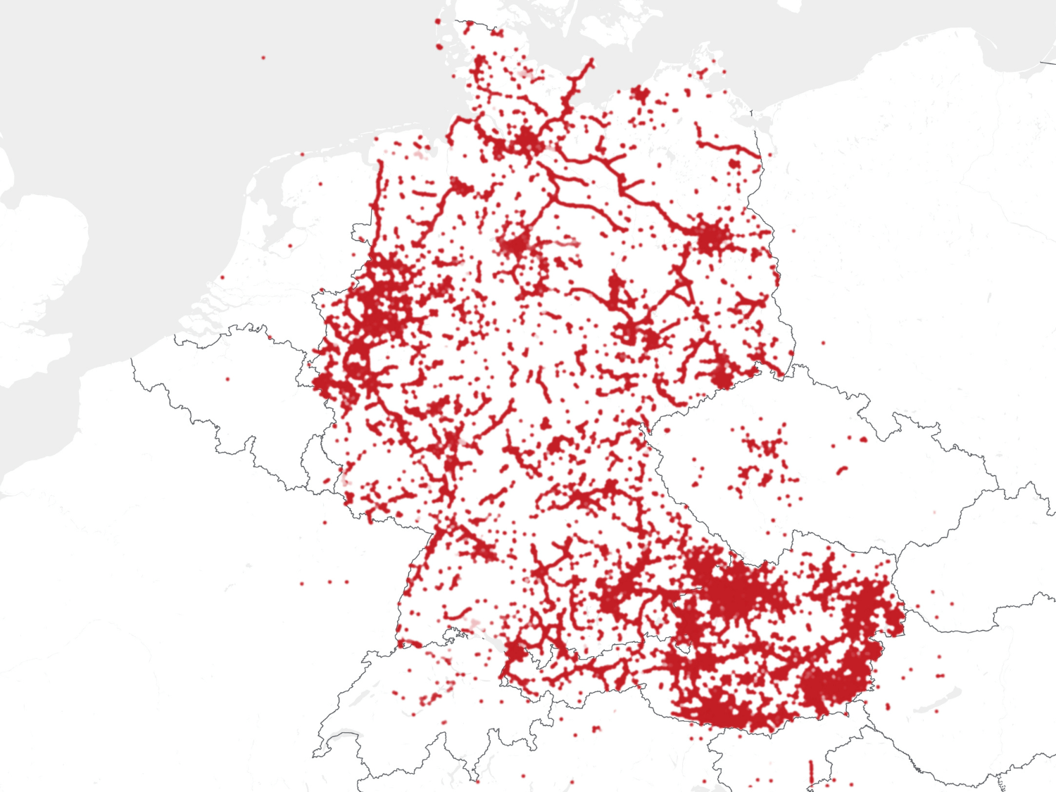
Used throughout Germany and Austria
2,000+ active users | 20,000+ projects | 4 million + points & photos
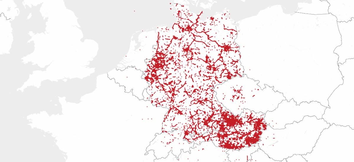
> 2,000 active users
> 20,000 projects
> 4 million points/photos
Testimonials
Nicolas – Site Manager, PFAFFINGER
With SitePlan, our site documentation and tracking run like clockwork.
Our foremen can independently document utilities and handle simple staking – no extensive training needed. All photos and data are digitally secured and centrally accessible. As a site manager, I have everything at my fingertips – without being on site.
⭐️ ⭐️ ⭐️ ⭐️ ⭐️
Dominik Schmidtzkonz – Site Manager, Pfaffinger Bau
Surveying and staking used to be time-consuming and error-prone,
we used string lines and measured everything manually. Now it's faster and more accurate – everything is digital. Workflows from site to office are smooth. SitePlan saves us real time and has become indispensable.
⭐️ ⭐️ ⭐️ ⭐️ ⭐️
David Mayer – Foreman, Felbermayr Bau
Previously, field measurements required several people – today, the foreman handles them alone, and with greater precision.
Digital surveying saves time, reduces errors, and simplifies billing. Ideal for landscaping and civil construction – from photo documentation to staking.
⭐️ ⭐️ ⭐️ ⭐️ ⭐️
Markus Aigner – Site Manager, Hitthaller
My foreman is thrilled he can stake out everything right away – no waiting!
On one job we had to lay 1,100 m of drainage. SitePlan was essential. The foreman handled all staking and documentation himself. I stay up to date from the office and have a clear billing record.
⭐️ ⭐️ ⭐️ ⭐️ ⭐️
Maximilian Rutar – Site Manager, STRABAG
A glance at the app replaces tedious plan reading – locations are instantly clear.
Existing utilities and structures are easy to locate. No more time-consuming tape measurements. Even older crew members work independently after just 10 minutes of training.
⭐️ ⭐️ ⭐️ ⭐️ ⭐️
Reinhold Schnelzer – Foreman, PORR Civil Works
Before SitePlan, making georeferenced plans available on site was a hassle.
Now everything is mobile and accurately positioned. The app provides all data, including GPS photos, directly on the tablet. Especially useful on linear projects – everyone works from the same, up-to-date data.
⭐️ ⭐️ ⭐️ ⭐️ ⭐️
Christoph Schwarz – Site Manager, Bernard Group (Pipelines & Plant Construction)
Our previous GPS system was complicated – SitePlan is radically easy to use.
It saves time on documentation and speeds up workflows. The support from the SitePlan team is fantastic – it’s perfect for construction companies of any size.
⭐️ ⭐️ ⭐️ ⭐️ ⭐️
Christian Penker – Managing Director, Infra-Connect
We use SitePlan across our equipment service division at DB Bahnbau.
Site inspection reports are created much faster. Photos and notes are clearly linked and nothing gets lost. Accurate GPS tagging provides the perfect foundation for planning.
⭐️ ⭐️ ⭐️ ⭐️ ⭐️
Andreas Saft – Head of Equipment Division, DB Bahnbau Group

Get to know SitePlan – hands-on and personal
In just 30 minutes, we’ll show you how to digitize photo documentation, field measurements, and staking – tailored precisely to your construction sites and workflows.
No obligations. No cost.


GDPR compliant & ISO 27001 certified
For the highest security standards
Frequently asked questions about our software
SitePlan is trusted by companies across civil engineering, utility construction, roadworks, and railway infrastructure – from small contractors to large corporations.
Clients include construction firms, engineering offices, and public authorities focused on digitizing their site operations.
We’re happy to share specific references during a meeting or demo.
SitePlan is used in civil construction for digital field measurements, staking, GPS photo documentation, and asset recording – from excavation to final billing.
Yes. SitePlan runs on any Android or iOS device. Without a GNSS antenna, it's ideal for GPS photo documentation. With a GNSS antenna, it becomes a full-featured surveying system.
Pricing depends on your use case.
We offer flexible license models – whether you need software only or a complete package including GNSS antenna, accessories, and correction data.
We’ll walk you through all Options in a short call to find the right fit – clearly and transparently. in a short appointment - tailored to your actual needs.
If you already have an antenna, we’re happy to check compatibility with SitePlan.
For a quick and hassle-free setup, we recommend our SitePlan GNSS Complete Kit – including a fully pre-configured antenna, all accessories, and active correction data.
Just turn it on and go – we handle the rest.
Absolutely. SitePlan was built for foremen, site managers, and cost engineers – no surveying degree required. The app is intuitive and ready to use immediately.
Yes. Many foremen use SitePlan independently after just 30 minutes of hands-on onboarding. We provide that training free of charge.
With a GNSS antenna, you’ll achieve centimeter-level accuracy – perfect for verifiable measurements and billing. Accuracy is shown in real time and automatically documented.
SitePlan is purpose-built for everyday civil site work – easy to use, ready in minutes, and ideal for non-surveyors. No complex workflows or file chaos – just photos, points, lines, and reports in one tool.
With a simple two-point georeferencing: click on two known coordinates, and you’re done. You can also import DWG/DXF files with embedded coordinate systems – no post-processing required.
Yes. All data (measurements, points, reports, photos) can be exported in formats like DXF, CSV, SHP, or PDF – ready for import into CAD and GIS tools. We also offer an API interface for integration with other systems.
Data security is our top priority. Our infrastructure and processes are ISO 27001-certified, the global standard for information security management.
All project data is encrypted during transmission and storage. Access rights are role-based – so you control who sees and edits what.
Your data is your property – never shared with third parties.
- Free trial (software only):
Test all app features free for 30 days on your own smartphone or tablet.
- Pilot project with full system (including GNSS):
Want to test SitePlan for real-world surveying and staking? We’ll provide a fully equipped rental kit – GNSS antenna, accessories, and correction data included.
Let’s have a quick call to find the best option for your needs – no risk, no obligation.
