Electronic measurement in civil engineering
18.03.2026
BIM in civil engineering: lots of buzzwords - but enormous potential
27.03.2026

The crew has laid 120 meters of drinking water pipe. Two bends, one branch, three manholes. The foreman resets the measuring wheel, the technician holds the measuring tape, the site manager writes. At the end, there is a sketch on paper - and the hope that the values will be accepted in the accounts.
Every meter counts when taking measurements in pipeline construction. It determines whether the construction work is paid for in full or whether there is a lengthy invoice reconciliation with the client.
Why measuring in pipeline construction is challenging
Pipeline construction is not structural engineering. No straight walls, no right angles. Routes follow the terrain, change direction, have height differences. There are also socket sections, house connections, bends, manhole structures, valves and crossings with existing pipes.
Each of these points must be documented - before the trench is backfilled. What is not recorded does not exist for billing purposes. And the time window is tight, the column often doesn't wait and fills the trench.
Classic measurement: where everyday life gets stuck
Measuring wheel along the trench, field measurement on the clipboard, sketch with lengths and fittings, recalculation in Excel and manual input into the accounting program.
- Sources of error. Measuring wheel on uneven or loose ground provides approximate values. Manual sketches are misinterpreted. Bends and fittings are estimated instead of measured.
- Time required. Two people for field recording, a third for post-processing. For complex routes, the office work takes longer than the recording.
- Settlement risk. If the client doubts the quantities and there is no reliable evidence, it will be expensive. The construction work has been completed, but the invoice has not been approved. No money for the work done.
Digital measurement: how it works
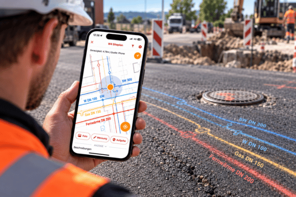
Smartphone with surveying app, connected to a GNSS antenna. The bezel is digitally recorded on site.
- Field recording. The foreman walks along the laid pipe. The app draws the saved points on the plan in real time - like Google Maps with site plans. Bends, junctions and fittings are set as points.
- Quantity calculation. Lengths and areas are calculated using the actual coordinates. No recalculation.
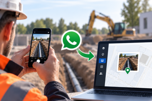
- Line documentation. Each point with GPS coordinates. Photos are georeferenced with time stamp and commentary. The position of the pipeline can be clearly traced even after backfilling.
- Export. Measurement report as PDF, data as DXF or CSV - in just a few clicks. Immediately available on the PC.
Accuracy: Measuring wheel vs. GPS
Measuring wheel provides approximate values at best on construction sites for excavation and embankments. For a 200-meter route, deviations add up to several meters.
With GNSS antenna: every single point is 1 to 3 cm accurate. Sufficient for billing bases, as-built plans and pipe surveys - without an external surveyor.

Typical scenarios in pipeline construction
Pressure pipes vs. gravity pipes
With pressure pipes (drinking water, gas, district heating), every bend, every fitting, every weld seam counts. Billing is based on individual items - if you don't document a bend, you are giving away money. Especially if this is also necessary.
In the case of gravity pipes (wastewater, rainwater), the gradient must also be taken into account. Invert heights at manholes, pipe lengths, changing nominal widths. One length is not enough here - the documentation must show the elevation. GNSS provides coordinates including height automatically.
Crossings with existing lines
The excavator uncovers a pipeline that is located somewhere else in the plan - or is not marked at all. If you record the existing pipeline with GPS photo documentation and coordinates before backfilling, you have reliable proof. If you don't do this, you are left without proof in the event of a dispute.
House connections and junctions
Are often measured between door and door - quickly, because the column is waiting. This is exactly where positions are lost: Fittings not noted, number of bends estimated, connection lengths rounded. With digital measurement, every connection is recorded as a point with coordinates - traceable, even after the trench has long since been backfilled.
Long route sections
With district heating or gas pipelines over several hundred meters, metering wheel errors add up. 1 % deviation over 500 meters is 5 meters - a noticeable amount when billing by the meter. GPS-supported measurement eliminates this cumulative error.
Further use cases
- Trench survey. Length calculated automatically. Width and depth digitally recorded.
- Line measurement. Record the position of the pipe to the centimeter - before backfilling.
- Location of shafts. Precisely measure manholes, gate valves and hydrants. Basis for as-built plans.
- Staking-out. Transfer planned routes from the plan to the natural environment. The foreman stakes out independently.
- GPS Photo Documentation. Photos with coordinates and time stamp. Evidence-proof for supplements and disputes. Automatically exportable as a photo report.
Time savings in comparison
Analog: 2 people, 1 to 3 hours recording, 30 to 60 minutes rework.
Digital: 1 person, recording during the construction process, hardly any post-processing. Practical values: up to 5 times faster.
The biggest leverage is not in measuring - but in eliminating rework: no transferring of sketches, no recalculation, no queries about missing measurements.
Economic effect
- Personnel costs. One person instead of two. Over one construction season: hundreds of working hours.
- Surveying costs. Line measurement and staking out internally instead of externally. Practical values: savings of up to €4,000 per month.
Billing security. Provide digital measurements with GPS coordinates and photo documentation Comprehensible billing bases. Fewer cuts, faster incoming payments.
Who is it suitable for?
Site managers, technicians and foremen in drinking water, waste water, gas, district heating and fiber optic pipeline construction. The decisive factor when selecting a solution is not the technology, but whether the site personnel use it from day one. If the foreman can measure independently after 10 minutes of instruction - without training, without prior IT knowledge - the hurdle is low enough for everyday use.
High-precision special measurements remain with the surveying office. The smartphone plus GNSS antenna is sufficiently accurate for 80 % of daily surveying tasks in pipeline construction.
Surveying in pipeline construction goes digital - or remains expensive
The pipe trench won't wait. Anyone still working with a measuring wheel and paper sketch pays twice: with working time and with missing billing statements.
The technology exists. The question is not whether - but how quickly it arrives at the construction site.